If you were a giant with hands the size of Wisconsin, what would our home state feel like to touch?
Could you feel the bumpy tree canopies of the Northwoods and the soft, stringy grasses in the driftless? Would you be able to follow our straight rows of corn and soy, and graze the cool, flat lakes and wetlands carved into the earth by glaciers thousands of years ago?

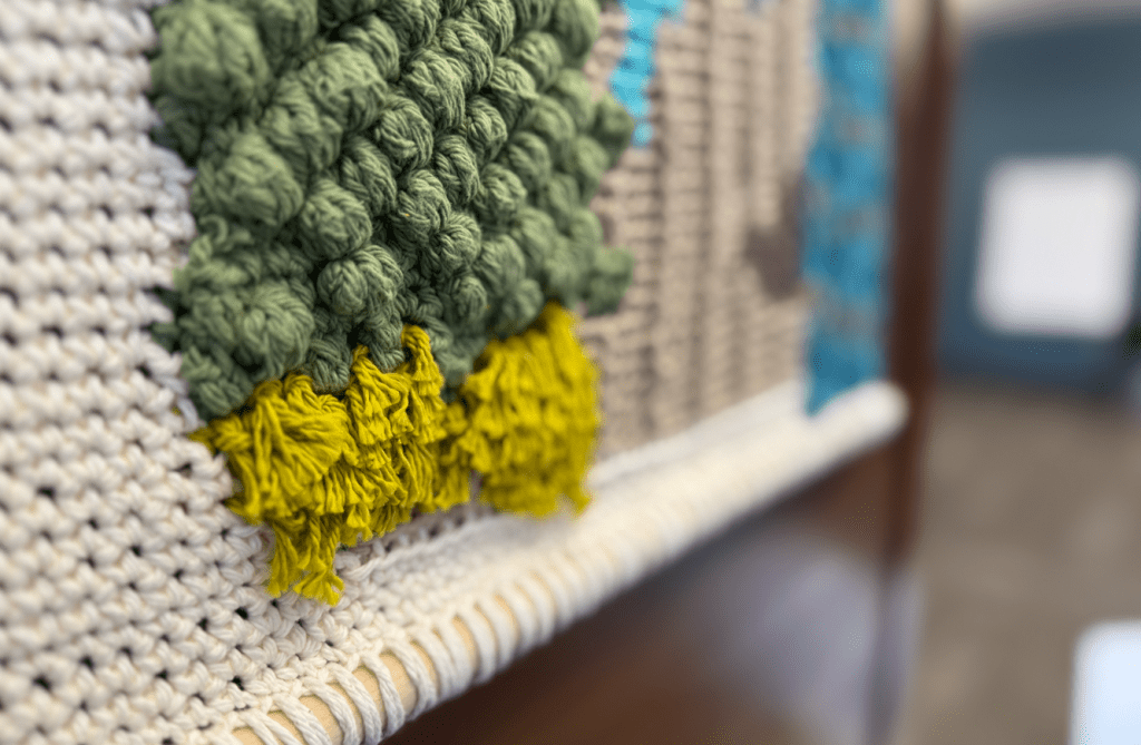
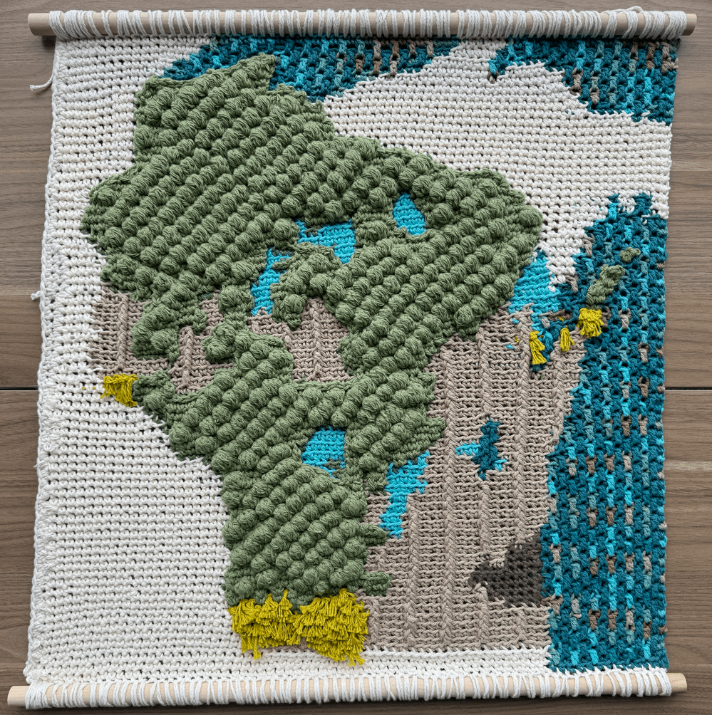
This map is an experiment in texture and generalization, and it uses a unique mix of physical and digital techniques to transform a highly detailed landcover dataset into a physical surface intended to be read as much with your hands as your eyes.
Recently, I used layers of crochet to make a bathymetric map of a lake near my home town of Madison, Wisconsin. Since then, I’ve wondered how I might use crochet to map other kinds of vector and raster data.
This map was a challenge to generalize. The data for this map comes from the Wisconsin Department of Natural Resources and was accessed via GeoData@Wisconsin and the UW-Madison Robinson Map Library.
The WISCLAND 2 (Level 1) Land Cover dataset provides a raster representation of Wisconsin’s physical surface as of 2016 at 30-meter resolution. To create this map, I applied a series of geoanalytical processes to greatly reduce the resolution and complexity of the data. This produced a raster image with a resolution more appropriate for the medium (approximately 1/226th the original resolution).
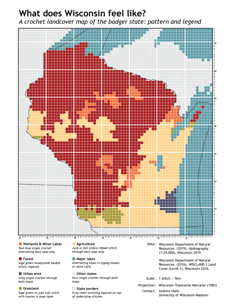
Download the pattern as a PDF.
I rendered the map by crocheting non stretching cotton yarn into the same geographic projection as the source data and preserved as much detail as can be perceived by human hands.
Crochet as a cartographic medium calls on us to reconsider our conceptualization of cartography, and data visualization in general, to include physical media. It often requires an extreme amount of generalization, blurring the lines between data graphic versus art, image versus sculpture, and digital versus physical.